



Transportation Tuesday: Greenhouse Gas Emissions
Using The Center for Neighborhood Technology’s Housing +Transportation (H+T®) Affordability Index mapping tools, the images below [...]

Monday Mapday: Rental Affordability in Georgia Cities
We recently looked at housing affordability in metro areas across the U.S. and in neighborhoods [...]

Changes in racial diversity of millennials/young professionals
As a whole, metro Atlanta is becoming increasingly diverse—but what about racial and ethnic diversity [...]

Transportation Tuesday: Freight Mobility Plan Update
The Atlanta Regional Commission (ARC) recently adopted an update to the Atlanta Regional Freight Mobility [...]

Monday Mapday: Hispanic Population Change in House Districts
Many parts of the state, especially in metro Atlanta, have experienced growth in the Hispanic [...]

School enrollment in fourteen metro Atlanta school districts
In Fall 2015, there were around 737,000 students attending schools in the fourteen school districts [...]

Transportation Tuesday: Affordability for a family of three with one worker
We recently shared a map that shows location affordability (based on housing and transportation costs) for [...]
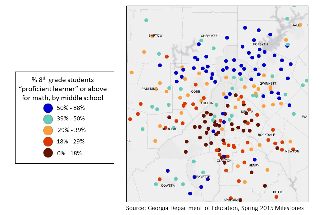
Monday Mapday: Middle School Math Milestones
Georgia Milestones is an assessment used by the Georgia Department of Education that replaced the [...]

Regional Snapshot: 2016 Population Estimates
For 50 years, or so, ARC has been developing population estimates for the Atlanta region. [...]

Transportation Tuesday: July’s Worst Traffic Jams (map)
Where were the worst traffic jams during July? This map shows the top 10 bottlenecks [...]