
Transportation Tuesday
Transportation-related posts, published every Tuesday.
Transportation Tuesday: Transportation and Warehousing Industry
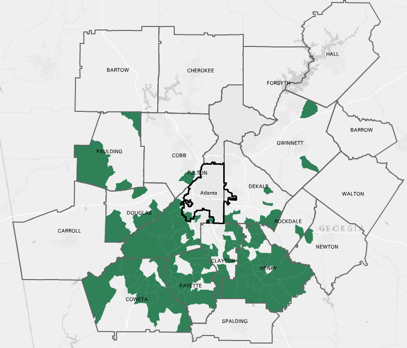
This map shows areas in metro Atlanta that have the greatest number of employees working in the Transportation & Warehousing industry (determined using the North American Industry Classification System). These areas are primarily concentrated in south metro [...]

Transportation Tuesday: 500,000 Visitors in Atlanta on Labor Day Weekend
An estimated 500,000 people visited Atlanta on Labor Day weekend to attend various holiday events. To see what kind of impact the influx of visitors had on traffic, the maps below compare travel speeds on the [...]

Transportation Tuesday: Commuting to Midtown
Midtown Transportation is a Transportation Management Association (TMA) that works with employers in midtown Atlanta to address local transportation issues and provide incentives to encourage the use of alternative commute methods like carpooling and public [...]

Transportation Tuesday: Worst Traffic Jams in August
Where were the worst traffic jams during August? This map shows the top 10 bottlenecks along metro Atlanta highways for the month of August (click image to enlarge). A bottleneck is a segment of roadway [...]

Transportation Tuesday: Long commute – driving alone
This map shows neighborhoods in metro Atlanta where the mean travel time to work is between 30 - 45 minutes, and where 85% or more of commuters drive alone to work. Driving alone on a long [...]

Transportation Tuesday: Greenhouse Gas Emissions
Using The Center for Neighborhood Technology’s Housing +Transportation (H+T®) Affordability Index mapping tools, the images below show greenhouse gas emissions throughout metro Atlanta. The data use transportation and household factors to model annual greenhouse gas emissions [...]