Accessing the internet from home has been an important way, for quite some time, to obtain educational resources outside of school. But during the pandemic, when remote schooling was the only schooling available, access to the Internet became synonymous with access to education. Fortunately, school leaders understood this and took innovative steps, including turning school buses into mobile hotspots and forming partnerships to make computing devices available to those in need.
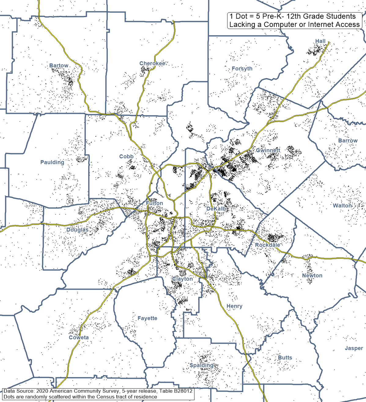
In the 2020 American Community Survey 5-year data released just last month, the Census Bureau created a new table on internet and computer access for students. Because these data represent surveys collected over the period 2016 through 2020 (and ACS operations requiring in person work were suspended for much of 2020), this gives us a good picture of Internet access pre-pandemic. We can identify areas where students would be most vulnerable to learning loss due to the pandemic, especially during the spring of 2020, by virtue of those students’ lack of an Internet subscription or of an Internet-capable device. Figure 1 below shows the density of households with students lacking access. Concentrations are notable along the northeast highway and major arterials into northeastern DeKalb and southwest Gwinnett County. There are clusters of school-aged population without access in southwest Atlanta, south Fulton, Clayton County–and also in the more urban centers of suburban counties like Cobb, Cherokee, and Rockdale.
Figure 1: Concentrations (Dot-Density) of Households w/ Children that Lack Internet Access

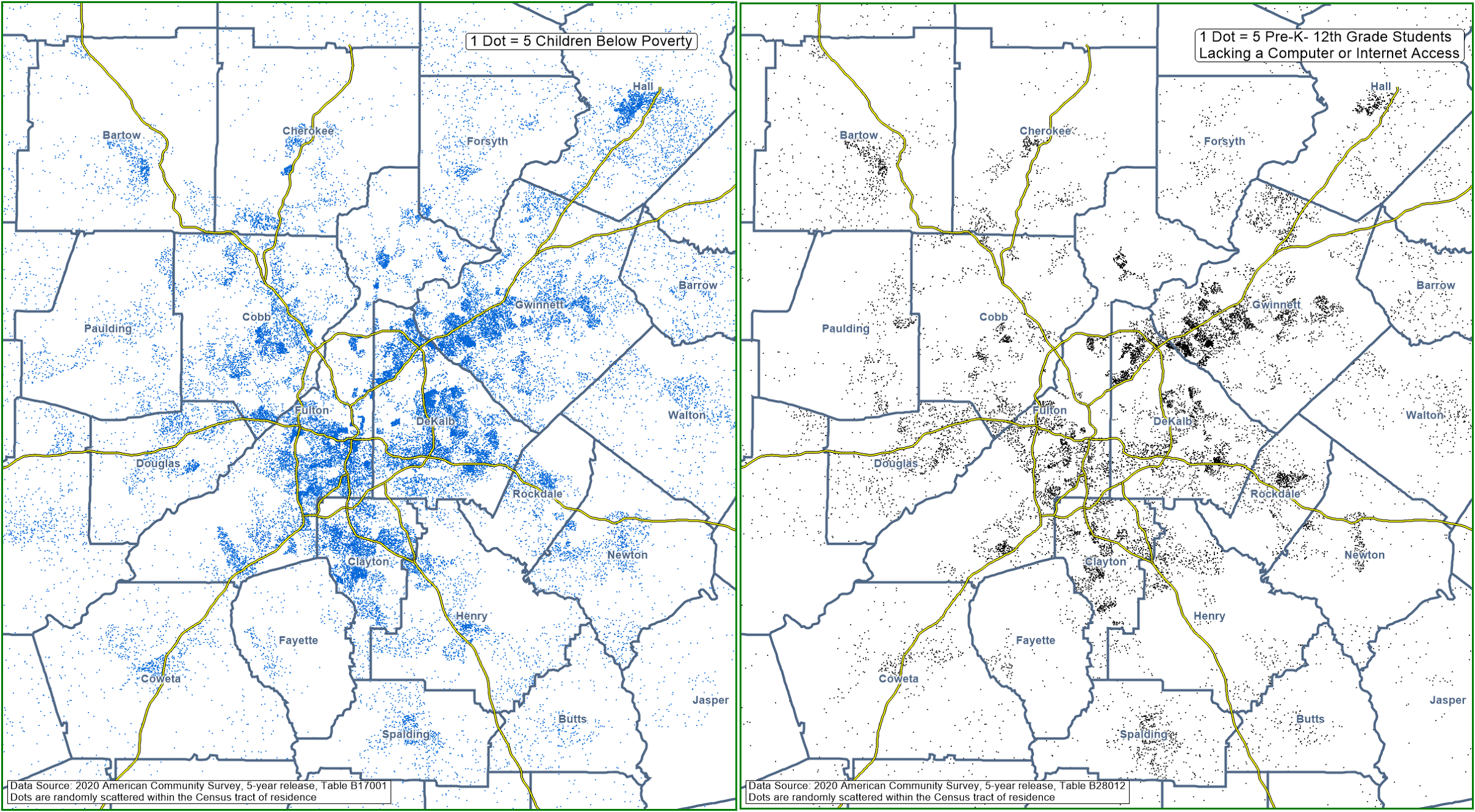
One might expect that lack of a computer or of Internet access would track with higher poverty rates, but that is true only to an extent. The percentage of children below poverty in a given area has only a moderate correlation with the percentage of pre-K through 12th grade students in the same area that lack a computer or Internet access (r=0.35), and so it is clear that other issues such as service availability must also come into play. Placing the poverty map and access map side-by-side (see Figure 2 below) allows for comparison of the spatial patterns.
Figure 2: Exploring Spatial Correlation of Broadband Access with Poverty

As we see in Figure 2 above, the Old 4th Ward neighborhood in Atlanta (located just northeast of the intersection of I-20 and the I-75/85 connector) has a fairly dense population of children below poverty but no corresponding concentration of students without Internet access. And the southeast corner of DeKalb County has relatively few children below poverty but a larger than expected number without Internet access.

