Transportation projects often take years, if not decades, to come to fruition due to the large amount of coordination needed to make them happen. Planning ahead can make this process less onerous, and sometimes the best way to plan ahead is to take a look back in time.
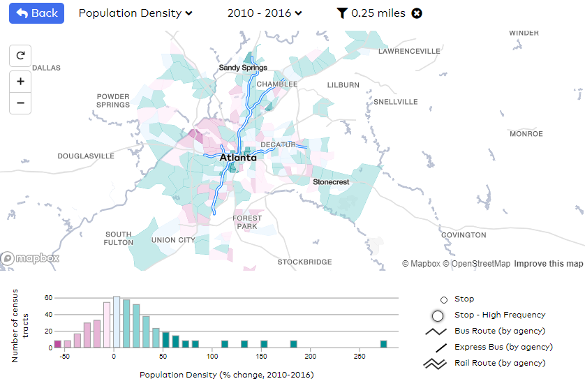
A new tool launched by TransitCenter helps make that process a little easier. They developed Transit Insights, which “combines information from the National Transit Database, the U.S. Census, and the route maps at Transit.Land into a visual format that allows for quicker, easier reference than querying multiple databases.” With this tool, you can compare historical transit ridership and operations trends among different systems, explore how neighborhood-level demographic changes correlated with transit infrastructure, and much more!
Click on the map below to learn more.