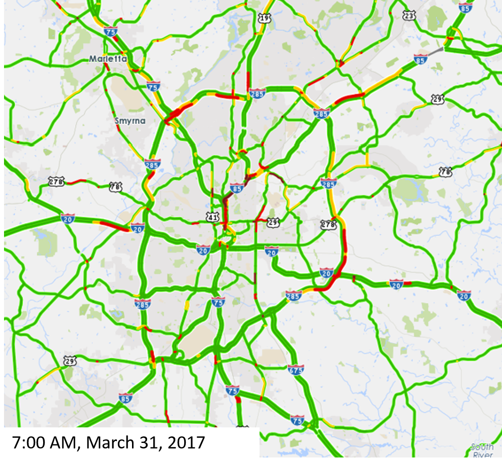
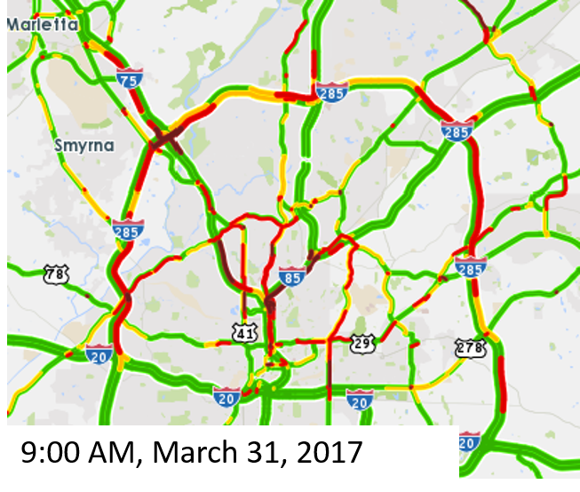
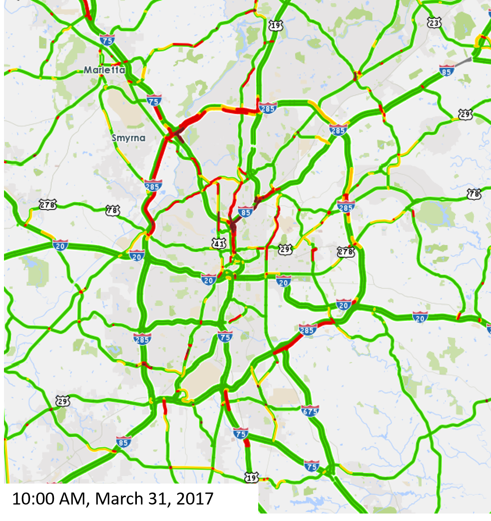
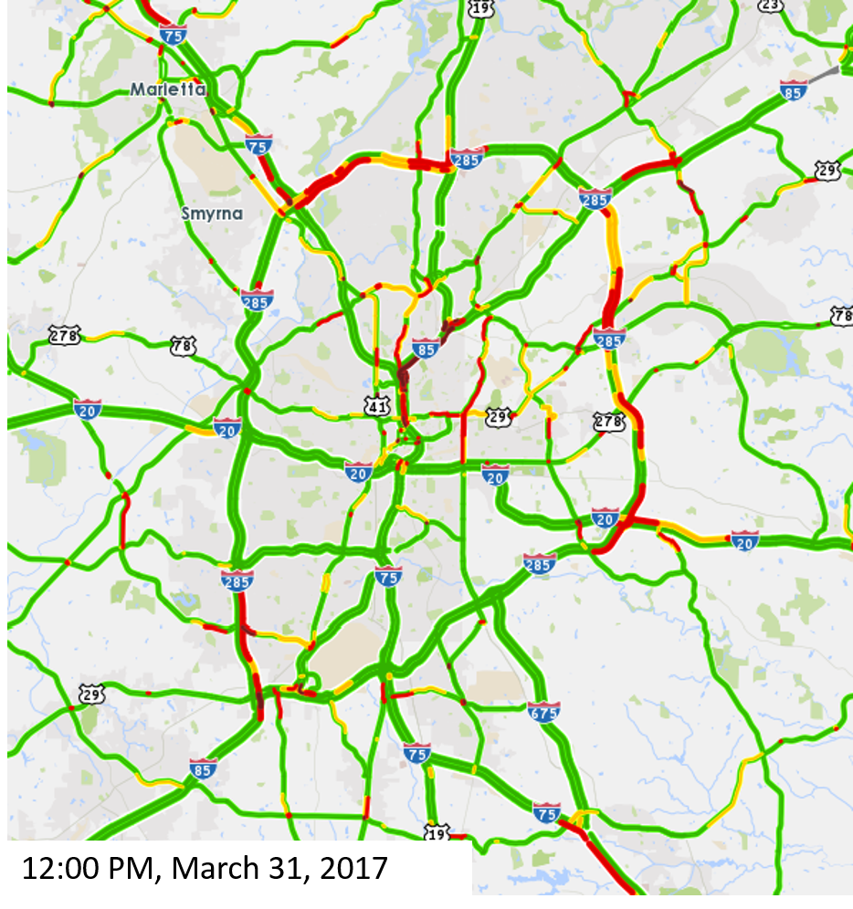
Following the fire and bridge collapse on I-85, commuters are changing their travel patterns. Many metro Atlanta residents may choose to take transit or stay home today, alleviating congestion on roadways, but for those still driving, here is a look at traffic on the major roadways on Friday, March 31. Check back for updates.
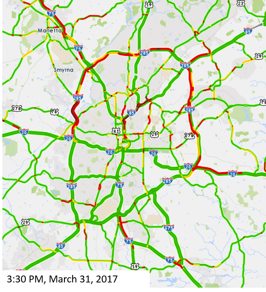
These maps use INRIX real-time traffic data. The colors show the current travel speed (for the selected time) compared to the historical average travel speed. The dark red areas have traffic speeds less than 25 percent of the historical speed, and bright red areas are traveling at speeds 25 – 55 percent of the historical speed. So, even though some of these roadways may typically experience congestion during rush hour, the red indicates that it is much worse than normal levels of congestion.
Click through the images to view changes in traffic throughout the day, and check back for updates.
Five maps are shown at different times throughout the day: 7:00 AM, 9:00 AM, 10:00 AM, 12:00 PM, and 3:30 PM.
We can see heavier traffic on along the northwest section of I-285, as well as in midtown and along smaller streets near midtown/downtown as commuters adjust their routes to work.