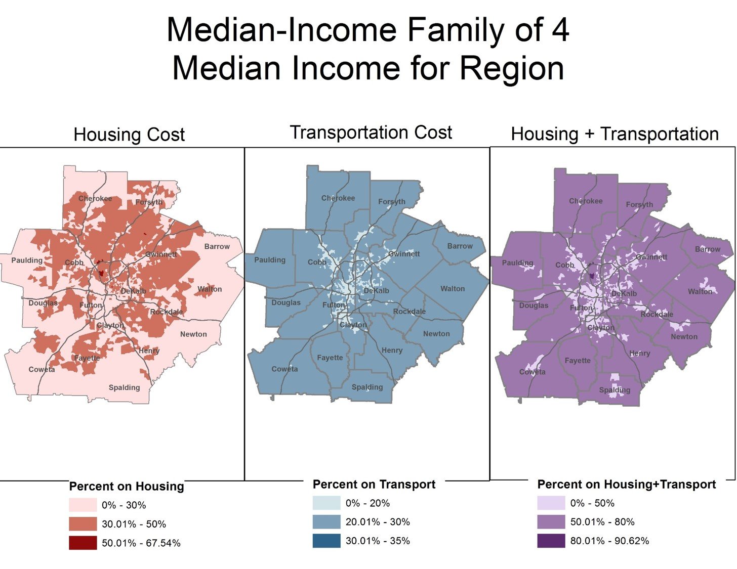
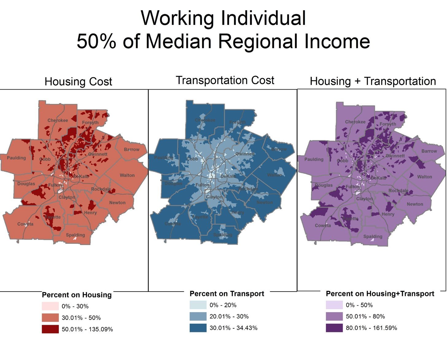
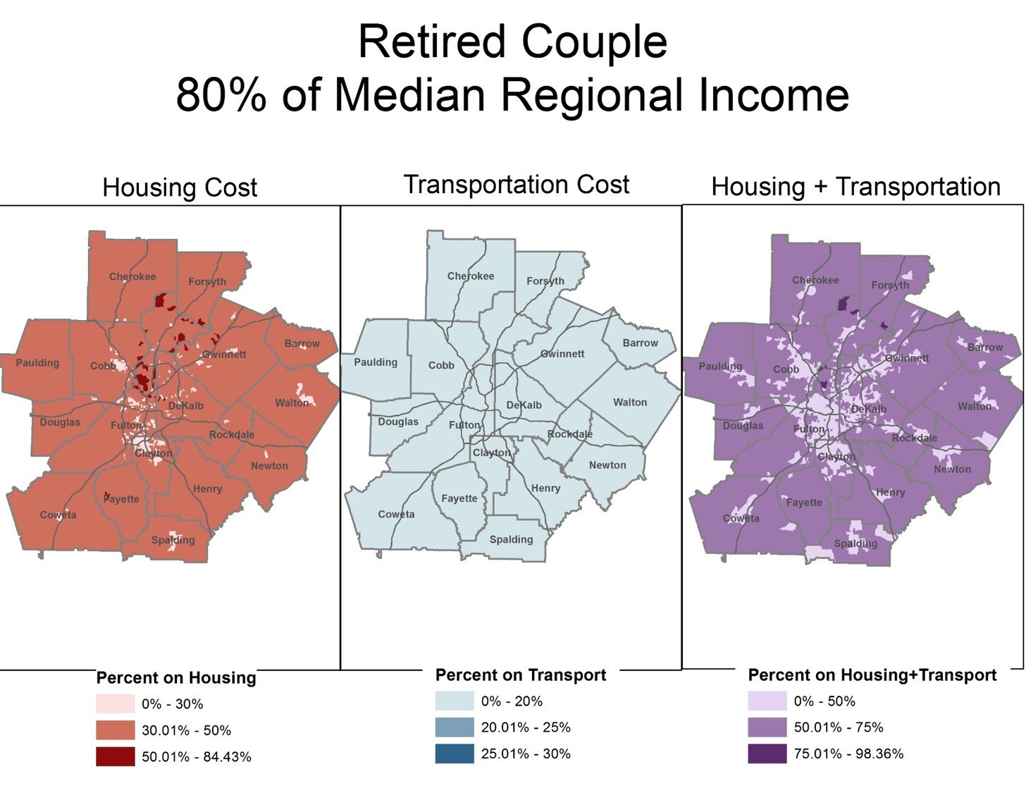
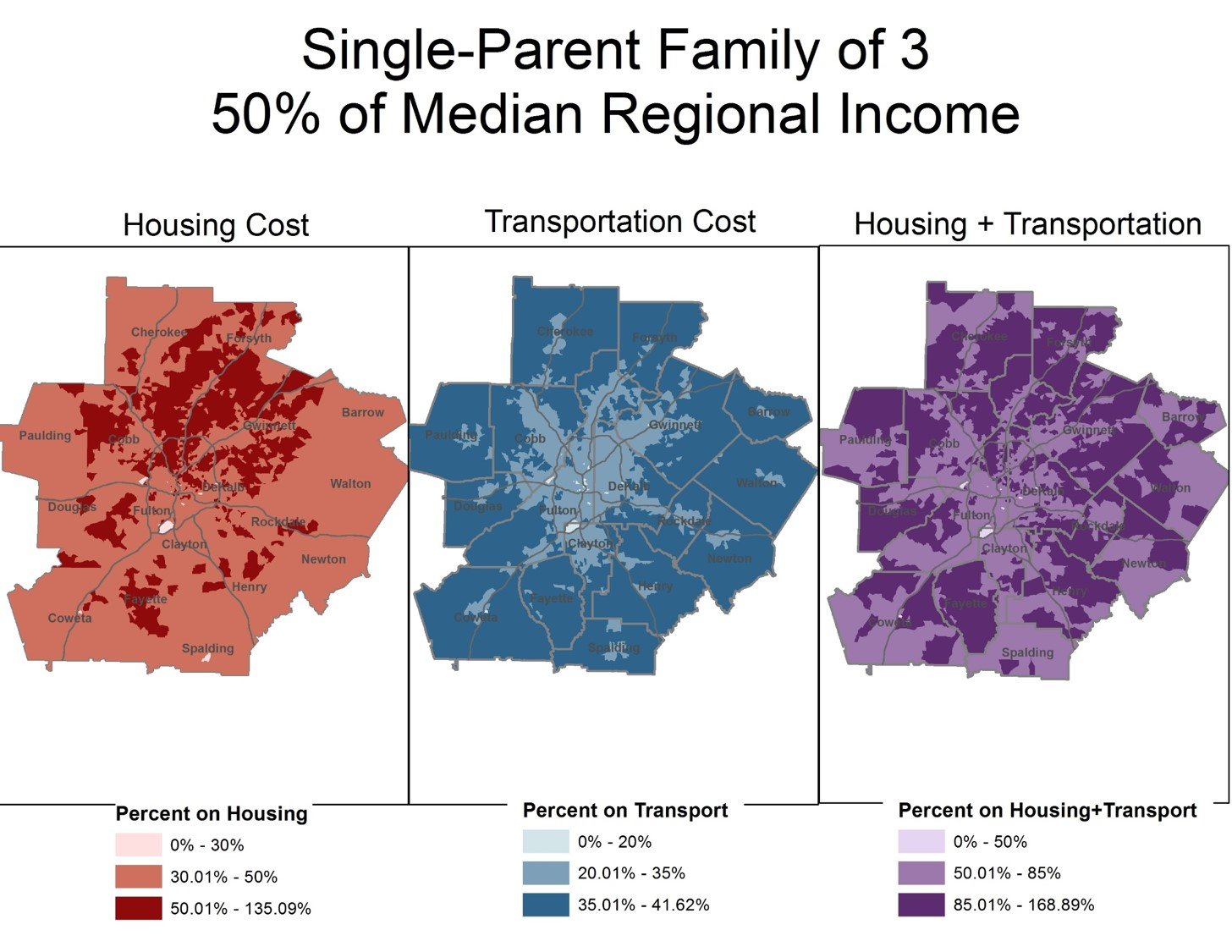
These maps show areas in metro Atlanta that are most affordable (considering transportation and housing costs) for five different scenarios of family composition and income:
- A median-income family of four
- A working individual earning 50% of median regional income
- A retired couple at 80% of median regional income
- A single-parent family of three earning 50% of median regional income
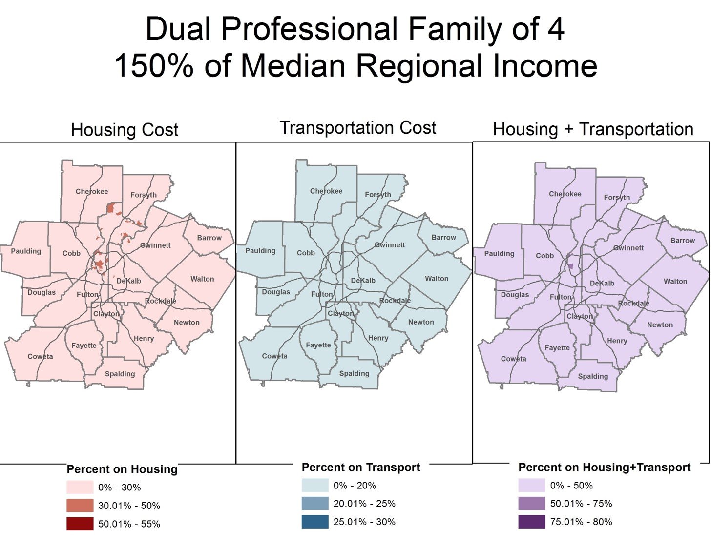
- A family of four earning 150% of median regional income
The lighter-colored areas are relatively more affordable, where households would spend a lower percentage of their income on housing and transportation costs.
These maps were developed by the Atlanta Regional Commission using data from the U.S. Department of Housing and Urban Development’s Location Affordability Index.