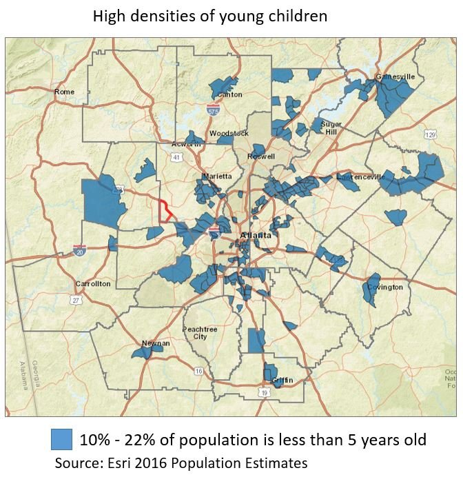
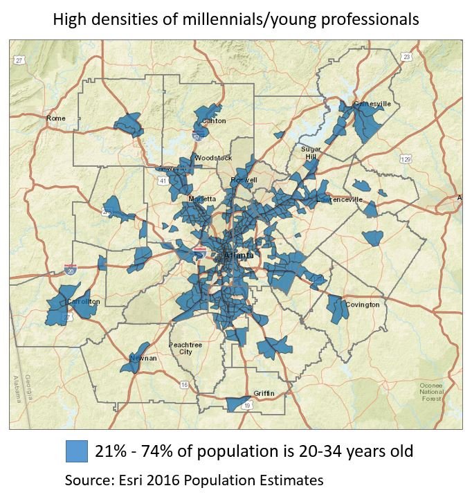
Our recent special feature Showing Our Age used Esri 2016 Population Estimates data to analyze age trends in metro Atlanta. These maps use the same data for a 20-county region to show spatial patterns in concentrations of millennials/young professionals (age 20-34) and young children.
The first map shows census tracts that have the highest densities of millennials. In these areas, 21% – 74% of the population is between 20 and 34 years old. This demographic is concentrated in the urban core: City of Atlanta, Fulton County DeKalb County, and Clayton County, and patterns also emerge in Gwinnett and Cobb counties.
The next map shows areas with high densities of children younger than 5 years old. In the blue census tracts, young children make up 10% – 22% of the population. These areas are relatively dispersed throughout the metro region, with concentrations in the northeast in Gwinnett, Forsyth, Hall, and Barrow counties.