
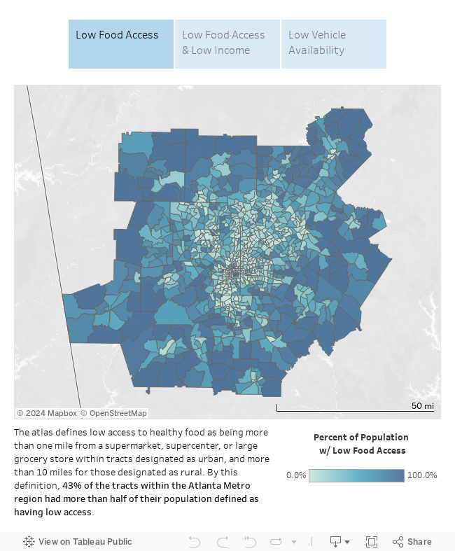
The United States Department of Agriculture (USDA)’s Food Access Research Atlas provides food access estimates by census tract across a variety of indicators, including proximity to grocery stores, family income, and vehicle accessibility. Estimates for the 2015 Atlas are based on a 2015 list of supermarkets, the 2010 Decennial Census, and the 2010-14 American Community Survey.
You can explore food access in 20-county Atlanta Metro region using the story map below.
* Low income tracts are defined as those with 20% of population in poverty or a median family income less than 80% of metropolitan median family income.
Source:
U.S. Department of Agriculture (USDA), Economic Research Service (ERS), Food Access Research Atlas, accessed on 7/3/2018