
With the hot summer months approaching and impacting air pollution levels in the region, we wanted to dive into ARC’s research on air quality and assess the most impacted areas in our community for this month’s Regional Snapshot.
Take a look at the highlights below, and check out the full report here.
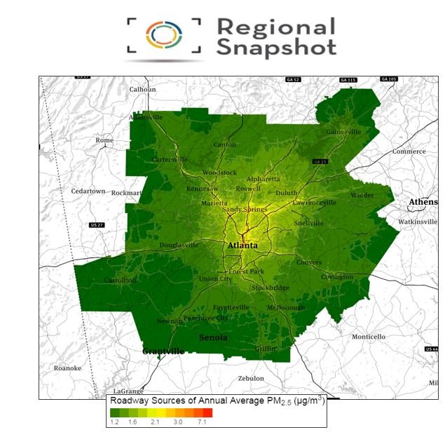
- The Clean Air Act requires areas of poor air quality (nonattainment areas) to have transportation plans that are consistent with air quality goals/ standards. Because sections of metro Atlanta fall within two nonattainment areas for Ozone and Particulate Matter (PM2.5), ARC addressed the issue by creating Atlanta Roadside Emissions Exposure Study (AREES) to take a look at traffic-related pollution levels surrounding roadways in the region. Areas with the highest concentrations include the downtown connector- such as Midtown, areas surrounding I-85N, and the northern portion of I-285.
- Understanding air quality at the neighborhood level is also important in addressing land use and site planning- particularly for schools where children are most vulnerable to the effects of air pollution. It can also help us identify communities that are affected, but may be underrepresented in local decision-making.
- In good news for Atlanta, Particulate Matter levels (PM2.5) have fallen within the 2012 standard and Ozone design values have also been falling over the last couple of years.