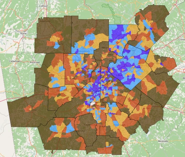
The Atlanta Region’s Plan was adopted by the Atlanta Regional Commission board on February 24. As part of the process, ARC has forecast population and employment change from 2015-2040. This map shows change in population density by census tracts, with the greatest concentrations of change occurring in central DeKalb and Fulton counties, Gwinnett County, and Forsyth County. To explore the interactive map and view other variables, use the Weave tool at https://www.neighborhoodnexus.org/.